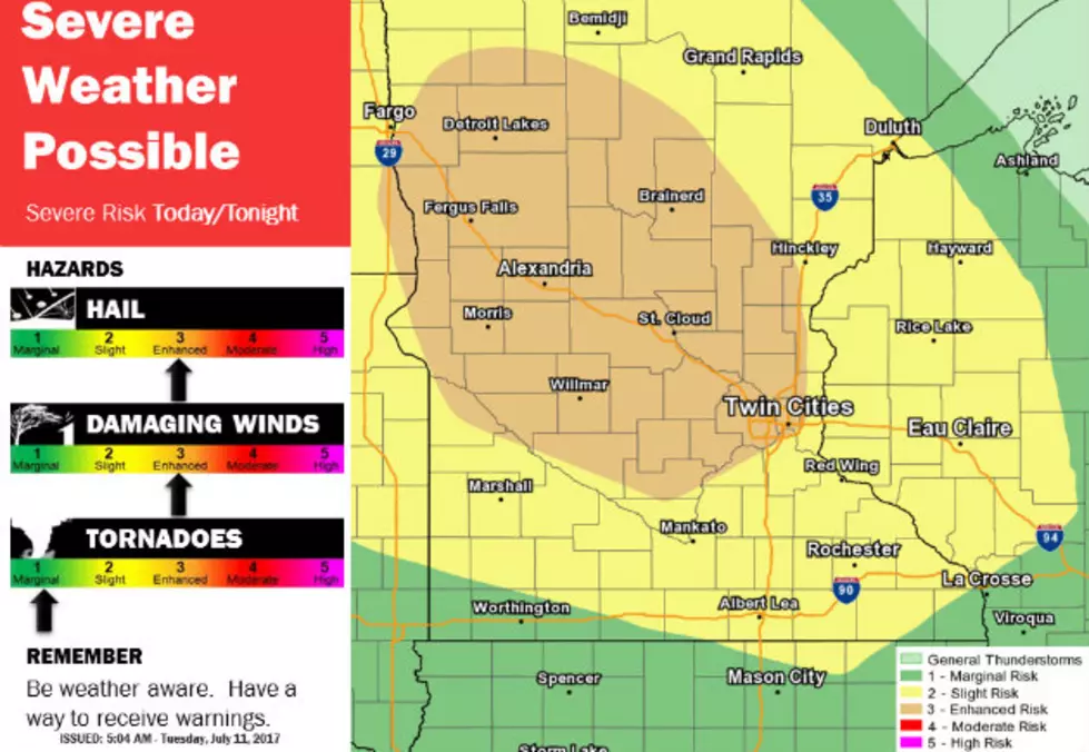
The National Weather Service says there's an enhanced risk of severe weather across Central MN today, with damaging winds, large hail, and a few tornadoes possible.
Our long hot and dry stretch of summer across the area will finally wane, but not before severe storms are possible across Central Minnesota tomorrow night.
High winds, large hail, and the threat of tornadoes were all in a line of strong storms that moved across central Minnesota Monday. Parts of Stearns, Morrison and Todd Counties were all under tornado and thunderstorm warnings. Parts of Benton and Sherburne counties had severe thunderstorm warnings issued.
The National Weather Service has issued a Severe Thunderstorm Watch for several counties in north central Minnesota, including Stearns and Benton counties until 11:00 p.m..
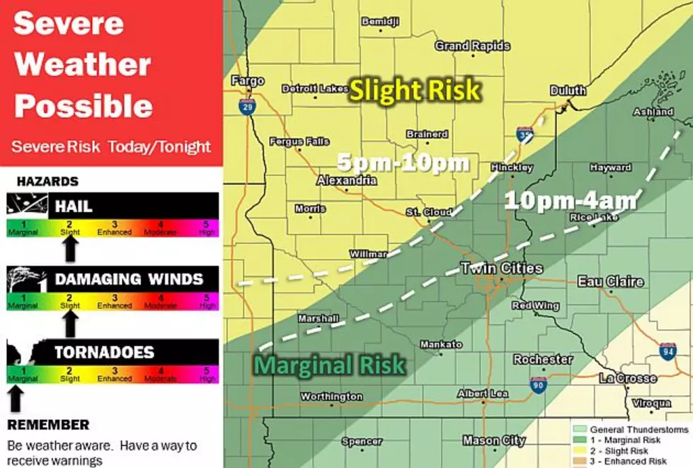
There is an Enhanced Risk of severe thunderstorms late this afternoon and tonight for much of central Minnesota, with a slight risk of severe thunderstorms for southern Minnesota into west central Wisconsin.
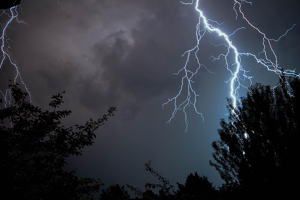
Holy-moly, it's getting scary out there!
With the warm weather comes severe weather season. Thunderstorms, lightning, high winds and tornadoes are all things we shouldn't take lightly. Here are a few safety tips from The National Weather Service that could just save your life!
Pay attention to the weather today, as strong cold front will sweep across Minnesota this afternoon and tonight -- triggering what the National Weather Service says could be severe storms producing damaging 75+ mph winds, baseball sized hail, and tornadoes. We'll have any watches & warnings on 103.7 The Loon.