Severe Storms Likely This Afternoon & Evening
The National Weather Service says widespread severe storms are likely this afternoon and evening across the region. Storms are expected to develop this afternoon, with the potential to produce damaging winds, large hail, and tornadoes.
For Saint Cloud, the severe threat increases after 1 pm, and is highest during the evening. The threat decreases after sunset.
The risk for tornadoes is highest across western into central Minnesota. A few intense long-track tornadoes (EF2 or greater) are possible. This is a rare set up and should be taken seriously.


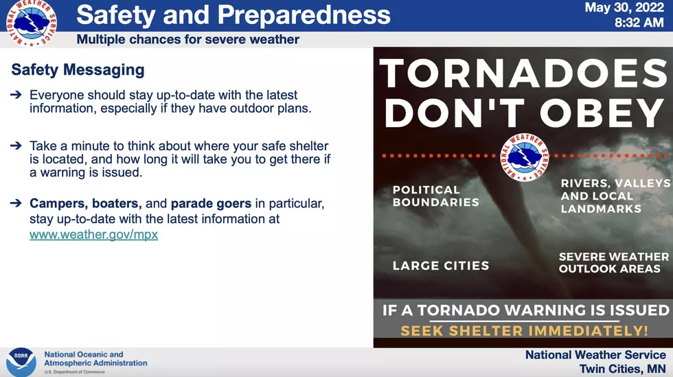
Uncertainty remains regarding the storm mode (supercells vs. line of storms), which will affect the type and severity of threat. Stay informed. Take time, think about where to shelter, how long will it take to get there if a warning is issued?
Remain weather-aware, and have multiple ways to receive warnings.
KEEP READING: What to do after a tornado strikes
More From 103.7 The Loon